 Sale!
Sale! Bring your wall alive with the world's gold standard of wall maps! From the mapcollectionyou've seen in classrooms, libraries, offices, coffee shops, and other public places all your life - now own one for yourself! As seen in the May 2003 issue of Nationa
Bring your wall alive with the world’s gold standard of wall maps! From the mapcollectionyou’ve seen in classrooms, libraries, offices, coffee shops, and other public places all your life – now own one for yourself!
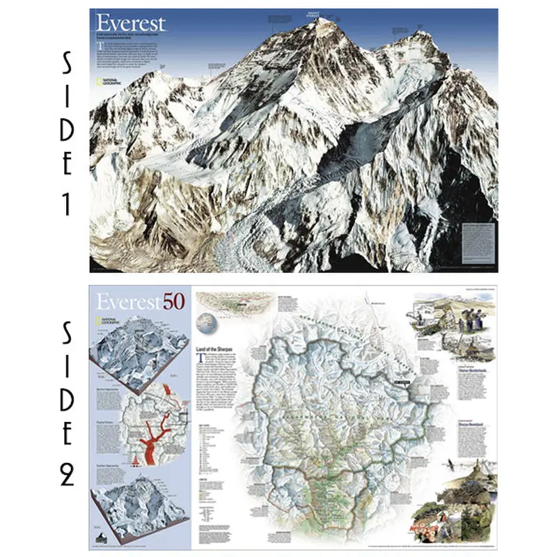
As seen in the May 2003 issue of National Geographic, this double-sided map celebrates the 50th anniversary of Sir Edmund Hillary’s ascent to the summit of Mt. Everest. Side one features a digital rendering of Mount Everest created from infrared images taken by the space shuttle combined with stereo photographs taken from a jet aircraft. The work of generations of surveyorsstretching back to the days of George Everest himselfundergirds like bedrock this most detailed digital model of Mount Everest. The reverse side shows a map of Sagarmatha National Park and surrounding areas. Inset maps and informative sidebars describe the Sherpas, special locations in the area, the growth in visitors to the region, and the routes taken by famous Everest expeditions..
This spectacular, extra-large 30″ x 47″ edition is the perfect sizeto include all the information in a visually appealing and legible way,ideal for any wallof your choosing. Everyone interested inthemajesty, drama, history, and geography of Everest can use this piece as an accent to home, office, cottage, classroom, library, or other public facility. Make this yours!
Cost - $25
Free Shipping We offer free shipping on orders over $30. Please check the free - shipping eligibility at checkout.
Delivery Time It usually takes [3-5] business days for standard shipping. Please note that this is an estimated time frame and may be affected by local holidays, and unforeseen circumstances.


Reviews
There are no reviews yet.